Precip for professionals
Every site you care about.
Measured, not guessed.
Monitor measured rainfall, snow, soil moisture, and the 10-day forecast across every field, property, and job site without installing physical weather stations. Get alerted when conditions cross your threshold, and pull the record into your own systems.
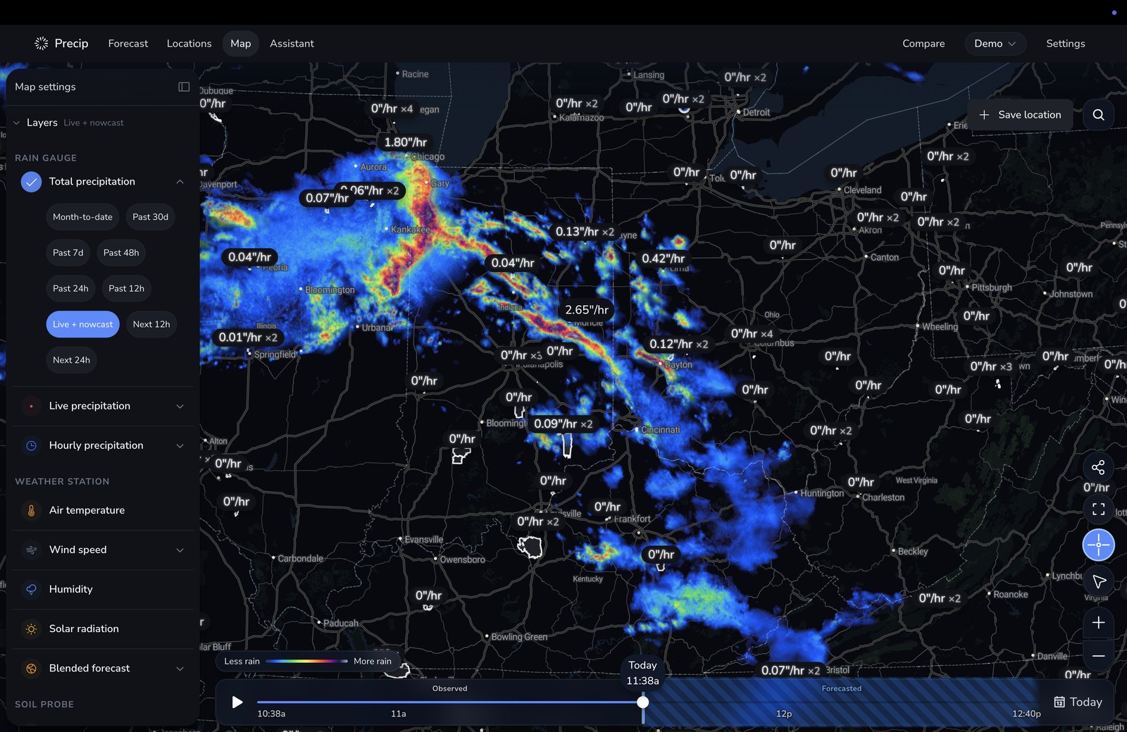
Multi-site operations
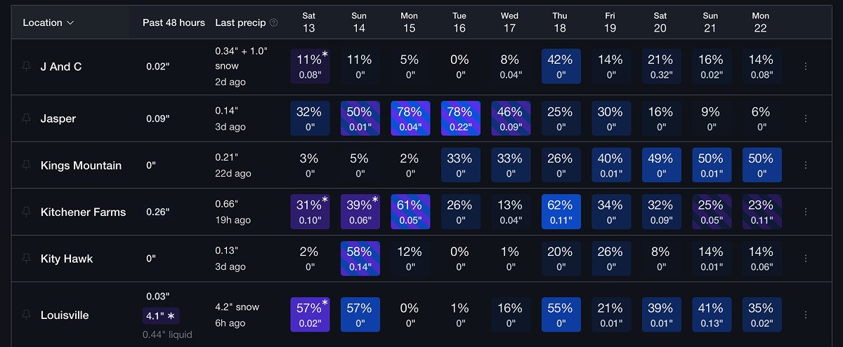
Every site on one screen, with no gauges to check.
See measured totals for the last 24 hours, when it last rained, soil conditions, and the 10-day forecast in the same row. Build your schedule from the record instead of driving out to check a site or calling customers to ask how much rain they got.
- No physical rain gauge per field: Precip measures each site from Doppler radar and quality-controlled gauges
- Save a site by search, or drop the map crosshair on a field, trailhead, or right-of-way with no street address
- Group sites by region, crew, customer, or crop, then filter to one group
- Sort by rainfall, last rain, soil moisture, temperature, wind, ponding, frost risk, or an active weather alert
- Pin the handful of sites that matter today to the top
What a professional plan adds
Built for running a professional operation.
Everything in the consumer app, plus the alerting, exporting, and shared access that a team needs to act on weather together.
Custom alert thresholds
Get told when a site crosses your line.
Write the rule once and let it watch every site for you. Precip checks measured conditions and the forecast against your threshold and sends the alert, so nobody has to babysit a radar loop to decide who works tomorrow.
- Precipitation, wind, or temperature, on measured conditions or on the forecast
- Fires above or below the amount you set, over a 12-hour, 24-hour, or 7-day window
- Continuous checks through the day, or a single scheduled alert at your hour
- Scope a rule to one site, a group of sites, or the whole organization
- Route it to yourself, specific teammates, or everyone, by push or email
- Quiet hours so an overnight storm does not wake the crew

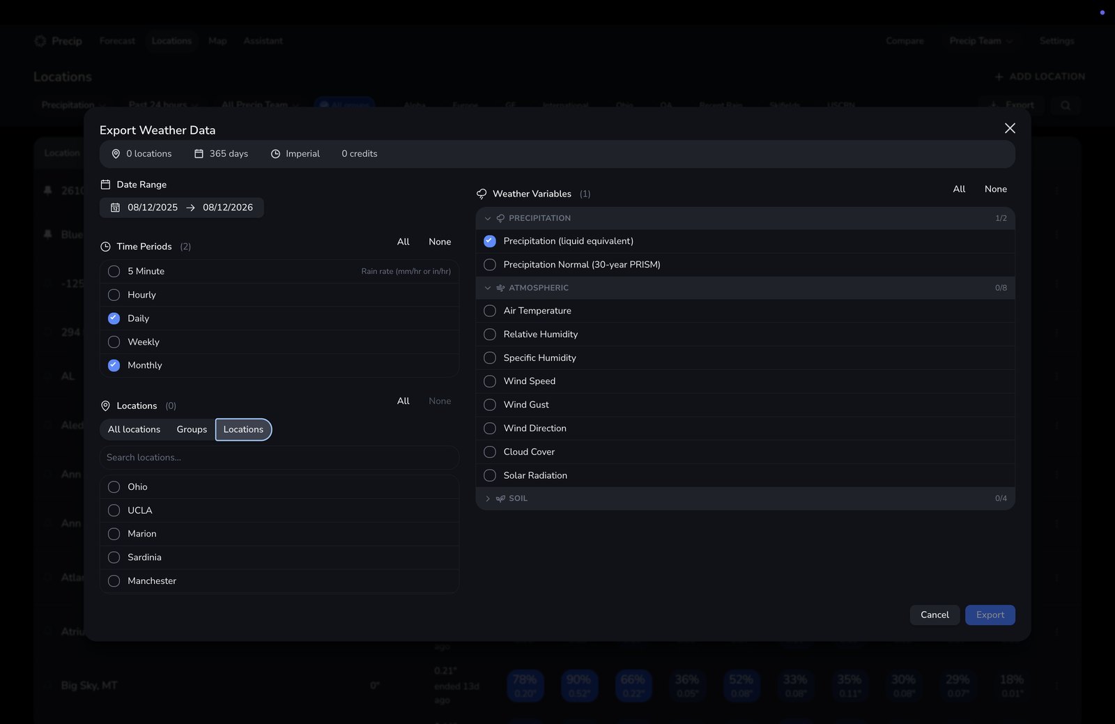
Data export
Take the record with you.
Pull an Excel or CSV export of measured conditions for as many sites as you need, then hand it to a claims adjuster, an agronomist, a project owner, or your own analysts.
- Precipitation, temperature, humidity, wind speed, gusts and direction, cloud cover, solar radiation, soil moisture, and soil temperature
- Roll it up into 5-minute, hourly, daily, weekly, or monthly intervals
- Up to five years of history in a single request
- Every site, one group, or a hand-picked selection
- Download it immediately, or let a large export finish and land in your inbox
- 30-year normals beside the measurements, so a season has context
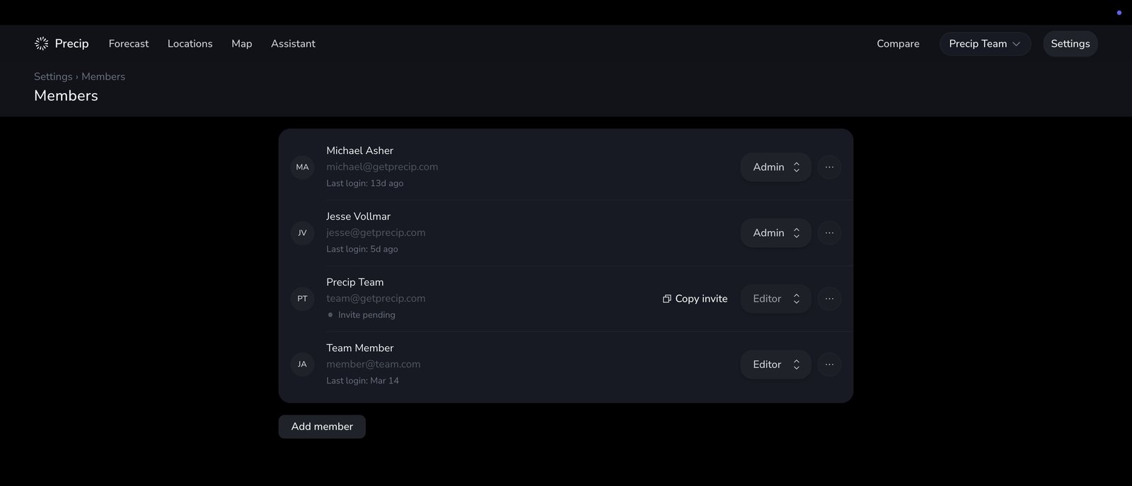
Multi-user organizations
A shared map for the whole team.
Sites, groups, and alert rules live with the organization instead of on one person's phone. When somebody leaves, the record stays.
- Invite teammates by email into a shared workspace
- Admin, editor, and viewer roles, so field crews can check conditions without changing anything
- Restrict a member to the groups of sites they manage
- Shared groups for regions, crews, customers, or crops
- Your logo in the app, and a year that starts on your fiscal, crop, or water year
Boundaries & bulk import
Bring the shapes and site lists you already have.
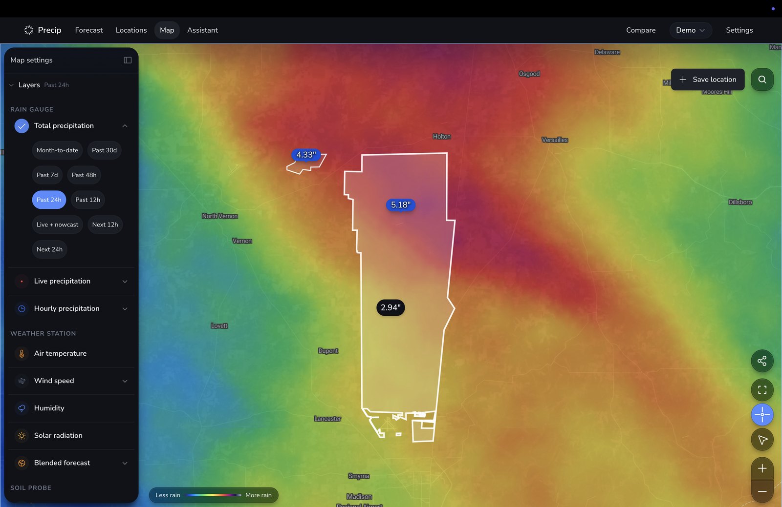
A pin answers for a point. A boundary answers for the whole field, parcel, or right-of-way, including how unevenly the rain or snow fell across it.
- Import a zipped shapefile, a KML, or connect an ESRI Feature Service URL
- Imported boundaries appear on the live map alongside your pins
- Area totals across the whole shape, not just its center point
- Average, lightest, and heaviest rainfall within the boundary, plus the spread
- Over the last 24 hours, 48 hours, 7 days, month to date, and 30 days
- Bulk import hundreds of point locations from CSV, Excel, or KML
Measured, not modeled
A record you can defend.
Precip fuses Doppler radar with a quality-controlled gauge network, so the total at a site is an observation rather than a forecast relabeled as history. Estimates keep improving as more gauge reports arrive for a storm.
A virtual rain gauge at every site, including the ones you would never put a physical gauge on.
Snowfall totals and snow depth, which a tipping-bucket gauge cannot measure at all.
The number for yesterday gets more accurate as additional gauge reports land.
Compare NOAA, ECMWF, DWD, and CMC against Precip's benchmarked 10-day blend before you dispatch a crew.
For developers
1 km weather history and forecasts, in one API call.
Put Precip's 1 km measured history, 60-minute nowcast, and 2.5 km 10-day forecast inside your own product. Pass a coordinate and get the record back via REST API, MCP server , or an embeddable map and chart UI.
- Precipitation
- Snowfall & snow depth
- Temperature
- Relative & specific humidity
- Wind speed, gusts, direction
- Cloud cover
- Solar radiation
- Soil moisture
- Soil temperature
const longitude = -83.7430;
const latitude = 42.2808;
const url = `https://api.precip.ai/v1/hourly?lon=${longitude}&lat=${latitude}`;

fetch(url, {
  headers: {
    'Accept': 'application/json',
    'Authorization': `Bearer ${YOUR_API_KEY}`,
  },
})
  .then(response => response.json())
  .then(data => {
    // Hourly rainfall history here
    console.log(data);
  })
See every storm
See how Precip fits your operation.
A short walkthrough with our team, using your own sites, so you can see the measured record before you commit to anything.
Schedule a demo