The best historical precipitation data
Precip automatically measures rain amounts with precision and accuracy. This guide serves as a simple overview of how the technology behind Precip works.
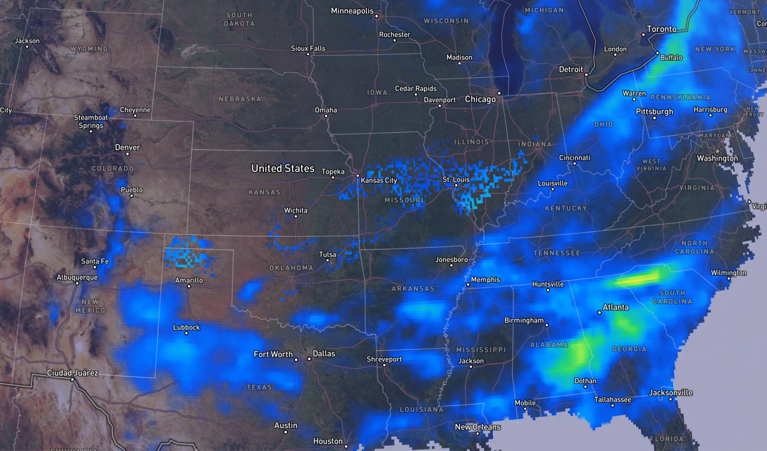
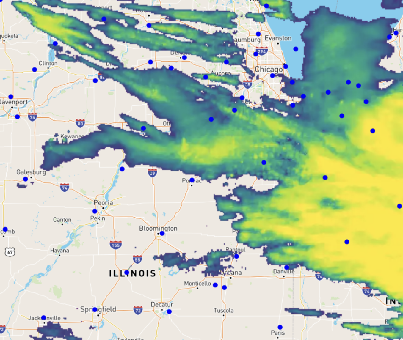
We use high resolution radar, and quality controlled gauge data to observe precipitation and model accumulation on the surface of the earth. We continually refine our data to be the most accurate and useful source for monitoring rainfall, snow, and other types of precipitation.
Why Precip has the best historical precipitation data
Most weather data sources are based on forecasts, not observations. That means they are often inaccurate, and don't reflect what actually happened. Precip is based on actual observations from radar, satellites, and rain gauges.
The Precip system uses observational data to track what actually happened, including 180 doppler radar stations and a quality controlled network of rain measurement stations.
Raw data gets processed through a series of scientific models that convert raw information into easy to understand precipitation amounts. Part of that process includes aligning data from multiple sources into the correct hourly time periods for reliable analysis.
The final stage of processing is creating a proprietary ensemble of the various model outputs to deliver the highest quality blend of low latency and highly refined data all correctly projected for geospatial analysis.
Coverage area & resolution
Precip data currently covers the United States, Canada, and some of Mexico with other regions becoming available upon request.
An important consideration is that our rainfall measurements in the US quantify rainfall for an area of roughly one half mile squared, or 160 acres. In Canada it is approximately 1 square mile or 250 hectares. Depending on the particular patterns of any given rainfall event, there could be varying amounts of precipitation even within an area that small. Our models will provide an average value for the area represented.
Why observations beat forecasts
Most sources that show historical rain totals only show the most recent forecast amount before the actual rain could be measured. Precip uses actual radar and ground-truth observations of actual rain as it happens to create the most accurate possible rainfall totals.
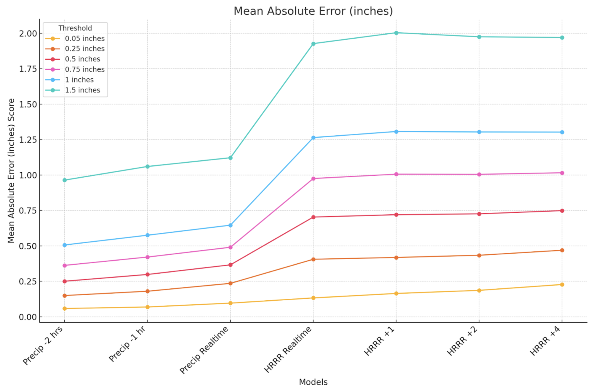
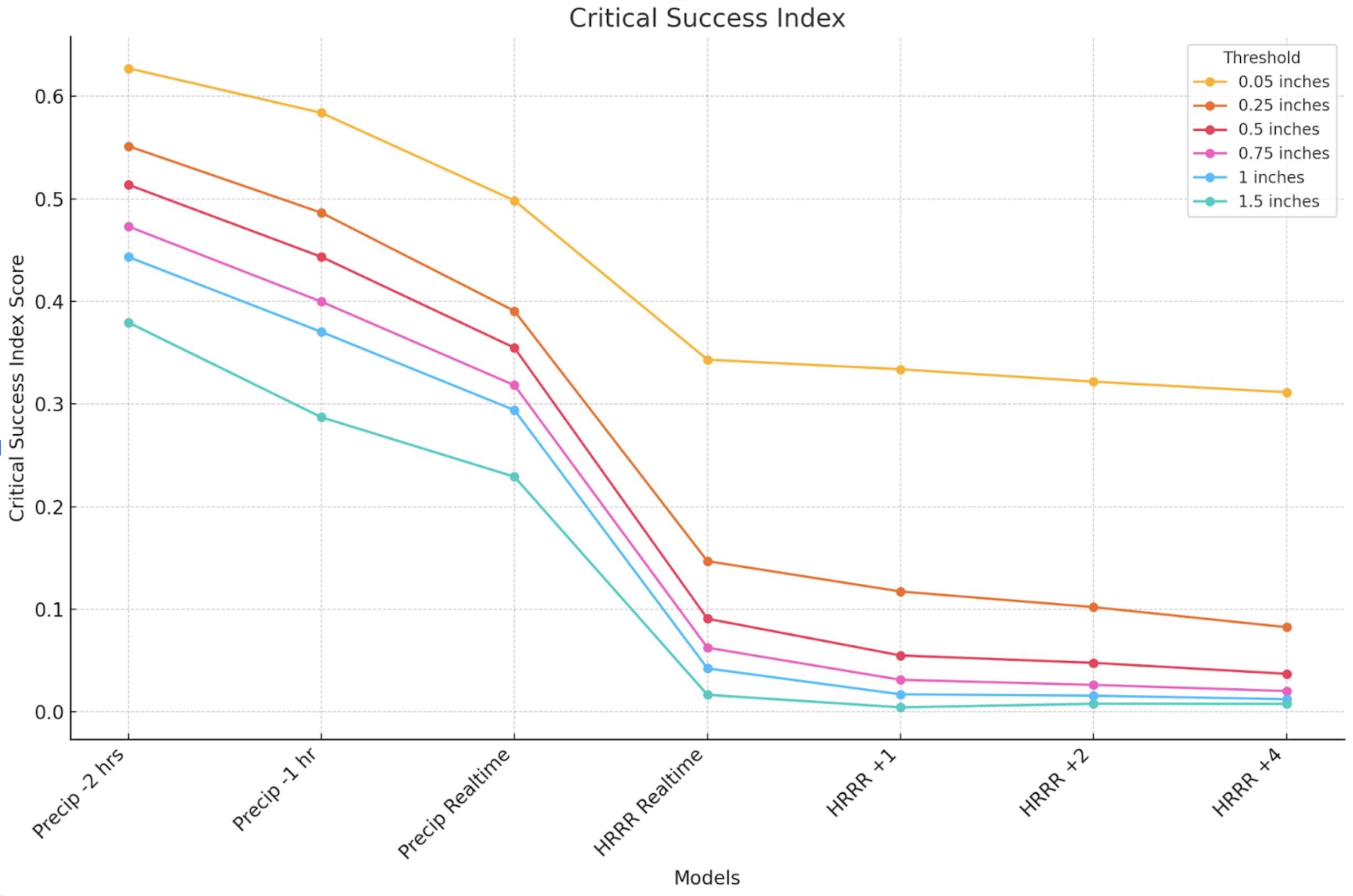
By using real observations, Precip is able to provide hourly totals that are 60% more accurate and 275% better rainfall detection than NOAA's High Resolution Rapid Refresh forecast.
Performance and benchmarks
Precip's estimates are the best available, but no rainfall estimate is perfect. In fact, rain gauges themselves can often provide inaccurate measurements. See our blog post about that here. One example is the estimate that wind turbulence causes a 2-10% average error rate when using gauges to measure rainfall. Our models account for wind and evaporation even though rain gauges do not.
The figures below are excerpts from a 2023 benchmarking study that compared Precip to the High Resolution Rapid Refresh forecast model output and the Integrated Surface Database ground observations. The report analyzes accuracy metrics for rainfall events at various accumulation thresholds as measured by the corresponding gauge data.
Third-party data sources
Precip incorporates data from the following third-party sources:
- NOAA — Doppler radar data.
- Open-Meteo — Weather forecast data.
- Rainbow AI — Precipitation nowcast data.
Questions or comments?
Email us at [email protected] or use the link below to learn more about Precip's data.
See how Precip can work for you
Schedule a customized demo with one of our expert team members today